Log in
All resources
Create a design
33,350 Free Images of Propaganda Map
bibliothèque nationale de france
a map of the british empire in america with the french and spanish settlements adjacent thereto
maps in the library of congress
curt teich postcard archives
map of maastricht by willem and johannes blaeu (1649)
turgot map of paris, kyoto university library – derivative files
philippe de la rué
postcards published by mid-west map
map postcards
postcards with 2 images
historical images of église saint-nicolas-du-chardonnet
map of paris by braun & hogenberg - derivative files
etchings in the rijksmuseum amsterdam
maps in the rijksmuseum amsterdam
map of paris by jouvin de rochefort (boutier 112)
maps of paris by françois de la pointe
old submaps of paris 5e arrondissement
turgot map of paris – derivative files
maps from traité de la police, bibliothèque nationale de france
third map of paris from traité de la police
jodocus hondius ii, nova totius terrarum orbis geographica ac hydrographica tabula, 1636
map
postcards of motels in california
curt teich postcard archives
henricus hondius ii, nova totius terrarum orbis geographica ac hydrographica tabula, 1630
eran laor cartographic collection
maps from traité de la police, bibliothèque nationale de france
first map of paris from traité de la police
the comprehensive history of england (1876)
historical images of st. james's palace
map of maastricht by willem and johannes blaeu (1649)
first medieval city wall of maastricht
british library king's topographical collection
map of paris by françois van hoey
geographia universalis (1545) in the british museum
german renaissance,northern renaissance
geographia universalis (1545) in the british museum
german renaissance,northern renaissance
geographia universalis (1545) in the british museum
german renaissance,northern renaissance
geographia universalis (1545) in the british museum
german renaissance,northern renaissance
geographia universalis (1545) in the british museum
german renaissance,northern renaissance
curt teich postcard archives
postcards of muncie, indiana
cartography
maps
turgot map of paris, kyoto university library – derivative files
palais royal (1634–1763)
map of paris by braun & hogenberg - derivative files
rue des archives (paris)
map of the german empire by louis stanislas d'arcy de la rochette
1773 maps of the holy roman empire
map of paris by jouvin de rochefort (boutier 112)
maps of paris by françois de la pointe
18th-century maps of havana
1730s maps of cuba
postcards of alaska
map postcards
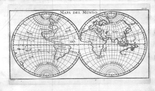
nicolas sanson. “mappe-monde, ou carte generale du monde.”
1667 map of madagascar by guillaume sanson
john rocque's 1748 map of london and adjacent country
a history of london (1884)
turgot map of paris, kyoto university library – derivative files
couvent des filles-saint-thomas
john rocque's 1748 map of london and adjacent country
a history of london (1884)
old maps of north america from the norman b. leventhal map center
1740 maps of north america
atlas des anciens plans de paris by imprimerie nationale, 1880 from bhvp
dheulland map of paris
brazilian paintings in the museu antônio parreiras
luiz christophe
collège de lisieux
collège du plessis
hôtel de choiseul (rue de richelieu)
salle favart i
seventh map of paris from traité de la police
geographic overlays
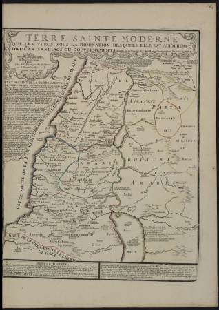
1720s maps of palestine
nicolas de fer
german-language maps from ios map collection
1910s maps of the balkans
map of ancient asia minor by philippe de la rué
bibliothèque nationale de france
map of ancient asia minor by philippe de la rué
bibliothèque nationale de france
map of ancient asia minor by philippe de la rué
bibliothèque nationale de france
map of ancient asia minor by philippe de la rué
bibliothèque nationale de france
map of ancient asia minor by philippe de la rué
bibliothèque nationale de france
postcards of elk city, oklahoma
curt teich postcard archives
map of maastricht by willem and johannes blaeu (1649)
jekerkwartier (maastricht)
map of maastricht by willem and johannes blaeu (1649)
meuse river in maastricht
1895 sanborn fire insurance map from new orleans, orleans parish, louisiana
maps in the library of congress
maps of the war of the spanish succession
apalachee
turgot map of paris, kyoto university library – derivative files
porte saint-antoine
map of paris by braun & hogenberg - derivative files
rue des archives (paris)
map of paris by jouvin de rochefort (boutier 112)
pont de grammont
a map of the british empire in america with the french and spanish settlements adjacent thereto
maps in the library of congress
a map of the british empire in america with the french and spanish settlements adjacent thereto
maps in the library of congress
a map of the british empire in america with the french and spanish settlements adjacent thereto
maps in the library of congress
a map of the british empire in america with the french and spanish settlements adjacent thereto
maps in the library of congress
a map of the british empire in america with the french and spanish settlements adjacent thereto
maps in the library of congress
french-language maps from ios map collection
old maps of carinthia
old submaps of paris 1er arrondissement
paris in the 18th century
a map of the british empire in america with the french and spanish settlements adjacent thereto
1730s maps of the caribbean
cartes generales de toutes les parties du monde (1658)
1650s maps of saxony
maps of paris from the david rumsey historical map collection
maps of paris by caspar merian
curt teich postcard archives, curt teich & company
postcards of cook county, illinois
postcards of madison county, illinois
curt teich postcard archives
windmills in amsterdam
singelgracht
postcards of creek county, oklahoma
curt teich postcard archives
maps from traité de la police, bibliothèque nationale de france
sixth map of paris from traité de la police
carta hydrographica y chorographica de las yslas filipinas
baroque painting
turgot map of paris, kyoto university library – derivative files
plans of the palais des tuileries
backs of postcards in curt teich postcard archives
postcards of miami, oklahoma
map of maastricht by willem and johannes blaeu (1649)
grote gracht (maastricht)
map of maastricht by willem and johannes blaeu (1649)
kleine gracht (maastricht)
backs of postcards in curt teich postcard archives
postcards of clinton, oklahoma
atlas géographique des quatre parties du monde (delisle)
map of europe by guillaume delisle (1700)
beschreibung der städt der welt - braun & hogenberg - btv1b52512111k
hierosolyma clarissima totius map by braun & hogenberg
beschreibung der städt der welt - braun & hogenberg - btv1b52512111k
hierosolyma urbs sancta map by braun & hogenberg
atlas géographique des quatre parties du monde (delisle)
map of italy by guillaume delisle (1700)
lawrence h. slaughter collection of english maps, charts, globes, books and atlases
nypl lionel pincus and princess firyal map division
claes jansz. visscher (i)
joannes van doetecum (i)
postcards of navajo county, arizona
curt teich postcard archives
john rocque's 1746 map of london
details of old maps of london
old submaps of paris 5e arrondissement
porte saint-victor (paris)
juliana of the netherlands in 1969
burgerzaal
1794 maps of the holy roman empire
english-language maps of europe
german-language maps from ios map collection
18th-century maps of the black sea
bern city map of 1638 by matthäus merian
baroque
map of paris by jouvin de rochefort (boutier 112)
historical images of hôtel de ville de paris
cartography
maps
british library - off the map alice collection - gardens
collections of the british library
british library - off the map alice collection - gardens
collections of the british library
british library - off the map alice collection - gardens
collections of the british library
1730s maps of south carolina
old maps of north america
curt teich postcard archives
postcards of miami, oklahoma
map of maastricht by willem and johannes blaeu (1649)
city gates in maastricht
dutch baroque architecture
mans spoor-dijkema
bern city map of 1638 by matthäus merian
baroque
maps
city
a map of the british empire in america with the french and spanish settlements adjacent thereto
maps in the library of congress
a map of the british empire in america with the french and spanish settlements adjacent thereto
maps in the library of congress
a new & correct map of england and wales (foster)
1750s maps of england
a map of the british empire in america with the french and spanish settlements adjacent thereto
1730s maps of the caribbean
works after map of amsterdam, 1544
maps in the rijksmuseum amsterdam
3001 - 3100 of 33,350
Next page
/ 334


![Third plan of the city of Paris, its extent and the towns which surrounded it under the reign of Louis the Young VII of the name [Digitized still image] / By MLCDLM, Antoine Coquart](https://cdn.creazilla.com/illustrations/10000255194/third-plan-of-the-city-of-paris-its-extent-and-the-towns-which-surrounded-it-under-the-reign-of-louis-the-young-vii-of-the-name-digitized-still-image-by-mlcdlm-antoine-coquart-md.png)


![Lutetia or first plan of the city of Paris taken from Cesar, Strabo, the Emperor Julian and Ammiam Marcellin [Digitized still image] / By MLCDLM, Antoine Coquart](https://cdn.creazilla.com/illustrations/10001210581/lutetia-or-first-plan-of-the-city-of-paris-taken-from-cesar-strabo-the-emperor-julian-and-ammiam-marcellin-digitized-still-image-by-mlcdlm-antoine-coquart-md.png)


![[View of Paris]. / Franciscus Hoiamis fecit., François Van Hoey, 1619](https://cdn.creazilla.com/illustrations/10000789014/view-of-paris-franciscus-hoiamis-fecit-franois-van-hoey-1619-lg.jpg)